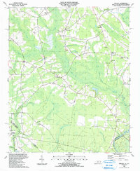
1990 Map of Pireway
USGS Topo · Published 1991About this map
Low-lying Carolina bays and intricate wetlands dominate this landscape near the South Carolina border, where the Waccamaw River cuts through the southeastern corner. Small agricultural and timber communities like Pireway and Butler Crossroads are connected by a network of rural roads that navigate around expansive terrain features such as Marsh Bay, Jenrette Bay, and Cross Bay. These large elliptical depressions, characteristic of the coastal plain, create natural boundaries for the settlements of Bug Hill and Pine Level.
Find a feature on this map
62 named features on this map. Tap any name to fly to it.
Don’t see what you’re looking for? This feature index may not catch every label — zoom into the map to look around manually.
Map Details
Editions of this 1990 Pireway Map
This is the sole edition of this map. No revisions or reprints were ever made.
Other maps of this area

1937 · Nixonville
USGS Topo · 1:48,000

1942 · Nixonville
USGS Topo · 1:62,500

1943 · Pireway
USGS Topo · 1:31,680

1943 · Nakina
USGS Topo · 1:24,000

1943 · Calabash
USGS Topo · 1:31,680

1943 · Freeland
USGS Topo · 1:24,000

1944 · Longs
USGS Topo · 1:31,680

1949 · Georgetown
USGS Topo · 1:250,000

1953 · Longs
USGS Topo · 1:24,000
1953 · Calabash
USGS Topo · 1:24,000