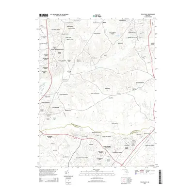
2014 Map of Piscataway
USGS Topo · Published 2014About this map
Accokeek and Piscataway anchor this Southern Maryland landscape as it appeared in the early 21st century. The map reveals a dense network of suburban developments such as Fort Foote Estates, Warburton Oaks, and Tantallon Square, which contrast with the older, established rural centers. Tracing the boundary between Prince George's Co and Charles Co, the survey documents the transition from historical riverfront estates like Warburton Manor to contemporary aviation hubs including Potomac Airfield and Washington Executive Airport/Hyde Field. This map is particularly valuable for genealogists and local historians, as it precisely locates community landmarks such as Saint Marys Cem and McKendree Cem, alongside smaller enclaves like Sharperville and Danville.
Find a feature on this map
105 named features on this map. Tap any name to fly to it.
Don’t see what you’re looking for? This feature index may not catch every label — zoom into the map to look around manually.
Map Details
Editions of this 2014 Piscataway Map
This is the sole edition of this map. No revisions or reprints were ever made.
Other maps of this area

1890 · Mt. Vernon
USGS Topo · 1:125,000

1891 · Mt. Vernon
USGS Topo · 1:125,000

1892 · Brandywine
USGS Topo · 1:62,500

1894 · Mt. Vernon
USGS Topo · 1:125,000

1895 · Brandywine
USGS Topo · 1:62,500

1897 · Mt. Vernon
USGS Topo · 1:125,000

1899 · Patuxent
USGS Topo · 1:125,000

1900 · Washington
USGS Topo · 1:62,500

1906 · Patuxent
USGS Topo · 1:125,000

1911 · Brandywine
USGS Topo · 1:62,500