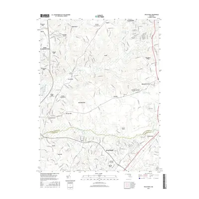
2016 Map of Piscataway
USGS Topo · Published 2016About this map
Accokeek and the northern outskirts of Waldorf define the landscape of this southern Maryland survey, where suburban expansion meets the winding drainages of the Piscataway Cr and Mattawoman Cr. The map captures a moment of modern residential development through numerous named subdivisions like Blandford Village, Accokeek Acres, and Bel Air Acres. Local heritage is preserved in landmarks such as Harmony Hall and the Zion-Wesley United Methodist Church Cem, which stand alongside contemporary aviation infrastructure at Washington Executive Airport/Hyde Field. This detailed record shows the boundary between Prince George's Co and Charles Co, documenting the dense network of local roads including Old Fort Rd and Danville Rd that connect longstanding communities like Piscataway and Clinton with newer residential clusters.
Find a feature on this map
82 named features on this map. Tap any name to fly to it.
Don’t see what you’re looking for? This feature index may not catch every label — zoom into the map to look around manually.
Map Details
Editions of this 2016 Piscataway Map
This is the sole edition of this map. No revisions or reprints were ever made.
Other maps of this area

1890 · Mt. Vernon
USGS Topo · 1:125,000

1891 · Mt. Vernon
USGS Topo · 1:125,000

1892 · Brandywine
USGS Topo · 1:62,500

1894 · Mt. Vernon
USGS Topo · 1:125,000

1895 · Brandywine
USGS Topo · 1:62,500

1897 · Mt. Vernon
USGS Topo · 1:125,000

1899 · Patuxent
USGS Topo · 1:125,000

1900 · Washington
USGS Topo · 1:62,500

1906 · Patuxent
USGS Topo · 1:125,000

1911 · Brandywine
USGS Topo · 1:62,500