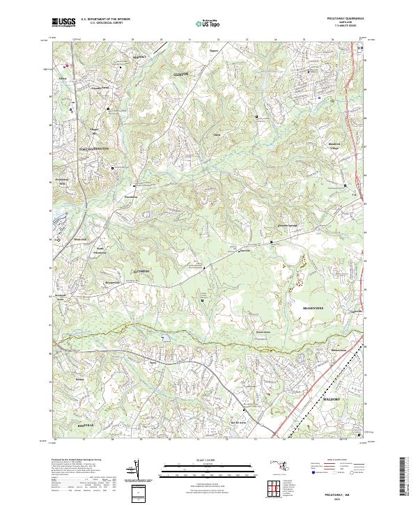
2023 Map of Piscataway
USGS Topo · Published 2023About this map
Piscataway Creek and Mattawoman Creek carve through this landscape at the border of Prince George's and Charles counties. The settlement pattern reflects a deeply rooted history, with early family landmarks like the Hatton Family Graveyard and Marbury Fendall Family Cem preserved alongside growing modern communities. The Potomac Heritage National Scenic Trl winds through the western reaches, connecting the colonial heritage of Fort Washington to the residential centers of Silesia and Accokeek. A notable concentration of historic congregations appears throughout the area, including the Providence United Methodist Church Cem and Saint Marys Catholic Church of Piscataway Cem, which serve as vital points for genealogical research. The map illustrates a rural-suburban hybrid, where quiet pockets like Thrift and Tippett sit between the more developed corridors of Clinton and Waldorf.
Find a feature on this map
58 named features on this map. Tap any name to fly to it.
Don’t see what you’re looking for? This feature index may not catch every label — zoom into the map to look around manually.
Map Details
Editions of this 2023 Piscataway Map
This is the sole edition of this map. No revisions or reprints were ever made.
Other maps of this area

1890 · Mt. Vernon
USGS Topo · 1:125,000

1891 · Mt. Vernon
USGS Topo · 1:125,000

1892 · Brandywine
USGS Topo · 1:62,500

1894 · Mt. Vernon
USGS Topo · 1:125,000

1895 · Brandywine
USGS Topo · 1:62,500

1897 · Mt. Vernon
USGS Topo · 1:125,000

1899 · Patuxent
USGS Topo · 1:125,000

1900 · Washington
USGS Topo · 1:62,500

1906 · Patuxent
USGS Topo · 1:125,000

1911 · Brandywine
USGS Topo · 1:62,500