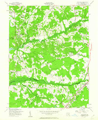
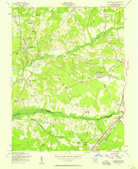
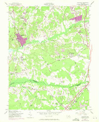
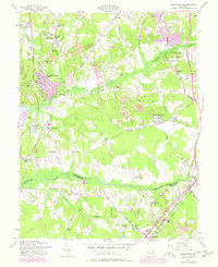
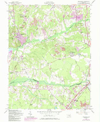
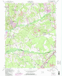
1957 Map of Piscataway
USGS Topo · Published 1963About this map
The boundary between Prince Georges Co and Charles Co defines this landscape during the mid-century suburbanization of Southern Maryland. The area shows a transition from rural agricultural land toward residential clusters, as seen in developments like Fort Washington Forest and Blandford Village. A deep religious and social history is etched into the terrain through various houses of worship, including St Marys Ch near the historic Piscataway settlement and the Zion Wesley Ch in the south.
Find a feature on this map
52 named features on this map. Tap any name to fly to it.
Don’t see what you’re looking for? This feature index may not catch every label — zoom into the map to look around manually.
Map Details
Editions of this 1957 Piscataway Map
6 editions found
Other maps of this area

1890 · Mt. Vernon
USGS Topo · 1:125,000

1891 · Mt. Vernon
USGS Topo · 1:125,000

1892 · Brandywine
USGS Topo · 1:62,500

1894 · Mt. Vernon
USGS Topo · 1:125,000

1895 · Brandywine
USGS Topo · 1:62,500

1897 · Mt. Vernon
USGS Topo · 1:125,000

1899 · Patuxent
USGS Topo · 1:125,000

1900 · Washington
USGS Topo · 1:62,500

1906 · Patuxent
USGS Topo · 1:125,000

1911 · Brandywine
USGS Topo · 1:62,500