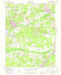
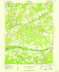
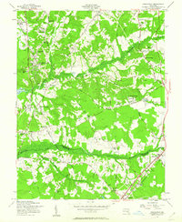
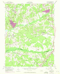
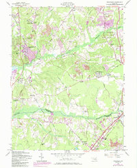
1957 Map of Piscataway
USGS Topo · Published 1978About this map
Piscataway and the surrounding rural landscapes of Prince George's County are documented here during a period of transition as suburban growth began to reach southward from Washington D.C. The map captures established communities like Silesia and White Hall, while also detailing the spread of mid-century residential developments such as Fort Washington Forest and Accokeek Acres. Local heritage is anchored by historic religious and burial sites, including St Marys Ch and the Ashbury Ch Cem, which serve as vital landmarks for genealogists tracing family histories in the region.
Find a feature on this map
78 named features on this map. Tap any name to fly to it.
Don’t see what you’re looking for? This feature index may not catch every label — zoom into the map to look around manually.
Map Details
Editions of this 1957 Piscataway Map
6 editions found
Other maps of this area

1890 · Mt. Vernon
USGS Topo · 1:125,000

1891 · Mt. Vernon
USGS Topo · 1:125,000

1892 · Brandywine
USGS Topo · 1:62,500

1894 · Mt. Vernon
USGS Topo · 1:125,000

1895 · Brandywine
USGS Topo · 1:62,500

1897 · Mt. Vernon
USGS Topo · 1:125,000

1899 · Patuxent
USGS Topo · 1:125,000

1900 · Washington
USGS Topo · 1:62,500

1906 · Patuxent
USGS Topo · 1:125,000

1911 · Brandywine
USGS Topo · 1:62,500