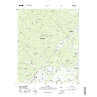
2019 Map of Pisgah Forest
USGS Topo · Published 2019About this map
Brevard and the northern reaches of Transylvania County are defined by the convergence of the French Broad River and its varied tributaries, including the Davidson River and Little River. In this 2019 landscape, the transition from the industrial legacy of Ecusta to the protected expanse of the Pisgah National Forest is clear. The northern terrain is marked by notable high points like Clawhammer Mtn and Black Mtn, while the unique high-altitude wetland area known as The Pink Beds sits near the headwaters of the South Fork Mills River. Genealogists will find a wealth of local heritage preserved in sites like the Boylston Baptist Church Graveyard, Davidson River Cem, and Osborne Cem, which are scattered throughout the valleys near Blantyre and Penrose. The map also documents modern infrastructure, such as the Transylvania Community Airport and the network of forest roads like Wagon Road Gap.
Find a feature on this map
189 named features on this map. Tap any name to fly to it.
Don’t see what you’re looking for? This feature index may not catch every label — zoom into the map to look around manually.
Map Details
Editions of this 2019 Pisgah Forest Map
This is the sole edition of this map. No revisions or reprints were ever made.
Other maps of this area

1905 · Pisgah
USGS Topo · 1:125,000

1906 · Pisgah
USGS Topo · 1:125,000

1935 · Cruso
USGS Topo · 1:24,000

1935 · Brevard
USGS Topo · 1:24,000

1935 · Standingstone Mtn.
USGS Topo · 1:24,000

1935 · Horse Shoe
USGS Topo · 1:24,000

1935 · Rosman
USGS Topo · 1:24,000

1935 · Shining Rock
USGS Topo · 1:24,000

1935 · Pisgah Forest
USGS Topo · 1:24,000

1936 · Skyland
USGS Topo · 1:24,000