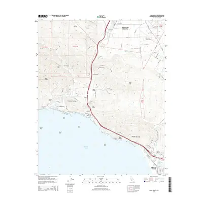
2015 Map of Pismo Beach
USGS Topo · Published 2015About this map
Avila Beach and the coastal communities of Central California define this 2015 survey, where the Santa Lucia foothills meet the Pacific. The landscape is dominated by the Irish Hills and several significant drainages, including San Luis Obispo Cr and Pismo Cr. Further inland, the San Luis County Regional Airport serves as a modern hub south of San Luis Obispo, while the southern reaches of the map track the development of Pismo Beach and Grover Beach. Local landmarks like Pirates Cove and Smugglers Cave highlight the rugged coastline, while thermal features such as Sycamore Springs and Ontario Hot Springs indicate the area's geological character. This map traces the transition from the high ridges of Indian Knob down to the coastal terraces of Shell Beach and Sunset Palisades.
Find a feature on this map
90 named features on this map. Tap any name to fly to it.
Don’t see what you’re looking for? This feature index may not catch every label — zoom into the map to look around manually.
Map Details
Editions of this 2015 Pismo Beach Map
This is the sole edition of this map. No revisions or reprints were ever made.
Other maps of this area

1897 · Port Harford
USGS Topo · 1:62,500

1897 · San Luis Obispo
USGS Topo · 1:62,500

1897 · Cayucos
USGS Topo · 1:62,500

1897 · Arroyo Grande
USGS Topo · 1:62,500

1900 · San Luis
USGS Topo · 1:125,000

1937 · Cayucos
USGS Topo · 1:62,500

1941 · Port San Luis
USGS Topo · 1:62,500

1942 · San Luis Obispo
USGS Topo · 1:62,500

1942 · Arroyo Grande
USGS Topo · 1:62,500

1943 · Cayucos
USGS Topo · 1:62,500