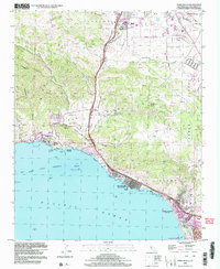
1998 Map of Pismo Beach
USGS Topo · Published 2002About this map
Pismo Beach and its neighboring coastal communities are recorded here just before the turn of the millennium, showing a landscape defined by the meeting of the Irish Hills and the Pacific Ocean. The map documents the intricate coastal development from the County Wharf at Avila Beach down through the unincorporated Shell Beach to the established streets of Grover Beach. Inland, the geography is marked by the steep canyons of the Irish Hills, including Wild Cherry Canyon and Harford Canyon, which give way to the more developed valley floor near San Luis Obispo. Notable landmarks of the era include the County Airport (McChesney Field) and the Pismo Lake Ecological Reserve, alongside smaller sites like the Bellevue Santa Fe Sch and Sycamore Springs. This survey provides a precise view of the region's late-20th-century infrastructure, capturing the transition between protected ecological zones and growing residential centers.
Find a feature on this map
48 named features on this map. Tap any name to fly to it.
Don’t see what you’re looking for? This feature index may not catch every label — zoom into the map to look around manually.
Map Details
Editions of this 1998 Pismo Beach Map
This is the sole edition of this map. No revisions or reprints were ever made.
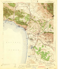
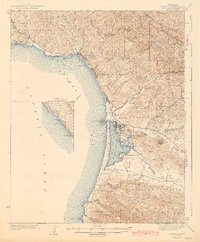
Other maps of this area

1897 · Port Harford
USGS Topo · 1:62,500

1897 · San Luis Obispo
USGS Topo · 1:62,500

1897 · Cayucos
USGS Topo · 1:62,500

1897 · Arroyo Grande
USGS Topo · 1:62,500

1900 · San Luis
USGS Topo · 1:125,000

1937 · Cayucos
USGS Topo · 1:62,500

1941 · Port San Luis
USGS Topo · 1:62,500

1942 · San Luis Obispo
USGS Topo · 1:62,500
1942 · Arroyo Grande
USGS Topo · 1:62,500
1943 · Cayucos
USGS Topo · 1:62,500