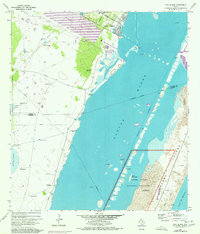
1969 Map of Pita Island
USGS Topo · Published 1977About this map
Padre Island National Seashore and the shallow expanse of the Laguna Madre dominate this coastal survey, where the barrier island landscape shifts between Shifting Sand and established wildlife areas like North Bird Island. The 1960s economy of this Kleberg County shoreline is defined by a dense network of energy infrastructure and ranching outposts. Numerous offshore Oil Wells and Gas Wells dot the waterway, while the mainland is marked by a distinctive series of named livestock landmarks, including Matanza Windmill, Encina Sola Windmill, and Guajolote Windmill. The presence of Waldron Field and the Intracoastal Waterway highlights the region's importance for both naval operations and maritime transit during this era of coastal development near Corpus Christi.
Find a feature on this map
34 named features on this map. Tap any name to fly to it.
Don’t see what you’re looking for? This feature index may not catch every label — zoom into the map to look around manually.
Map Details
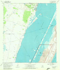
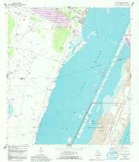
Editions of this 1969 Pita Island Map
3 editions found
Other maps of this area

1925 · Oso Creek
USGS Topo · 1:62,500

1950 · Corpus Christi
USGS Topo · 1:250,000

1951 · South Bird Island
USGS Topo · 1:24,000

1951 · Crane Islands NW
USGS Topo · 1:24,000

1951 · South Bird Island NW
USGS Topo · 1:24,000

1951 · Oso Creek NW
USGS Topo · 1:24,000

1951 · Oso Creek NE
USGS Topo · 1:24,000

1951 · Crane Islands SW
USGS Topo · 1:24,000

1951 · Oso Creek
USGS Topo · 1:62,500

1951 · Crane Islands
USGS Topo · 1:62,500