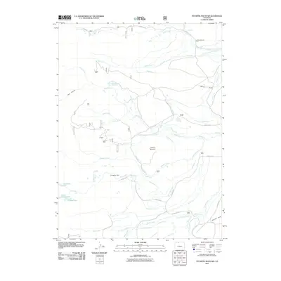
2011 Map of Pitchpine Mountain
USGS Topo · Published 2011About this map
Carlstrom Brothers Ranch and Brands Ranch anchor a high-altitude landscape defined by extensive ranching operations and water management in the early 21st century. The terrain is crisscrossed by an intricate network of irrigation ditches, including the Erik Ditch, Lillie Ditch, and Norrell DITCH, which divert water from natural flows like Lone Pine Creek and the Roaring Fork. These man-made channels support livestock and agricultural life across Livingston Park and the slopes of Pitchpine Mountain.
Find a feature on this map
59 named features on this map. Tap any name to fly to it.
Don’t see what you’re looking for? This feature index may not catch every label — zoom into the map to look around manually.
Map Details
Editions of this 2011 Pitchpine Mountain Map
This is the sole edition of this map. No revisions or reprints were ever made.
Other maps of this area

1911 · Hahns Peak
USGS Topo · 1:125,000

1913 · Hahns Peak
USGS Topo · 1:125,000

1954 · Craig
USGS Topo · 1:250,000

1955 · Lake John
USGS Topo · 1:24,000

1955 · Buffalo Pass
USGS Topo · 1:24,000

1955 · Mount Zirkel
USGS Topo · 1:24,000

1955 · Pitchpine Mountain
USGS Topo · 1:24,000

1955 · Mount Ethel
USGS Topo · 1:24,000

1955 · Teal Lake
USGS Topo · 1:24,000

1955 · Delaney Butte
USGS Topo · 1:24,000