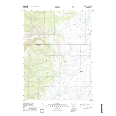
2019 Map of Pitchpine Mountain
USGS Topo · Published 2019About this map
Livingston Park sits near the heart of this high-elevation landscape, where the headwaters of the Roaring Fork and Raspberry Cr carve through the southern reaches of the Routt National Forest. The 2019 survey reveals a complex irrigation network essential for ranching and water management in Jackson County, featuring named canals like the Erickson and Bohn Extension Ditch, Sunday Cr Ditch, and Wolfer Ditch. In the southwest, the Rainbow Lakes chain, including Lower Rainbow Lake and Middle Rainbow Lake, marks the alpine terrain near Ceanothus Lake. These water features, alongside landmarks like Pitchpine Mtn and the Red Canyon Reservoir, illustrate how historical water rights and natural topography dictate the land use in this part of the Colorado Rockies.
Find a feature on this map
60 named features on this map. Tap any name to fly to it.
Don’t see what you’re looking for? This feature index may not catch every label — zoom into the map to look around manually.
Map Details
Editions of this 2019 Pitchpine Mountain Map
This is the sole edition of this map. No revisions or reprints were ever made.
Other maps of this area

1911 · Hahns Peak
USGS Topo · 1:125,000

1913 · Hahns Peak
USGS Topo · 1:125,000

1954 · Craig
USGS Topo · 1:250,000

1955 · Lake John
USGS Topo · 1:24,000

1955 · Buffalo Pass
USGS Topo · 1:24,000

1955 · Mount Zirkel
USGS Topo · 1:24,000

1955 · Pitchpine Mountain
USGS Topo · 1:24,000

1955 · Mount Ethel
USGS Topo · 1:24,000

1955 · Teal Lake
USGS Topo · 1:24,000

1955 · Delaney Butte
USGS Topo · 1:24,000