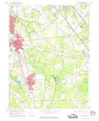
1966 Map of Pitman East
USGS Topo · Published 1968About this map
The suburban and academic landscape of Glassboro and Pitman is defined by institutional growth and the lingering industrial patterns of the mid-20th century. Glassboro State College dominates the western portion of the map, while the surrounding area shows the intricate road network connecting Clayton and Cross Keys. The presence of the Pennsylvania-Reading Seashore Lines highlights the historical transit corridors that shaped these Gloucester County communities.
Find a feature on this map
105 named features on this map. Tap any name to fly to it.
Don’t see what you’re looking for? This feature index may not catch every label — zoom into the map to look around manually.
Map Details
Editions of this 1966 Pitman East Map
3 editions found
Other maps of this area

1888 · Mount Holly
USGS Topo · 1:62,500

1890 · Hammonton
USGS Topo · 1:62,500

1890 · Glassboro
USGS Topo · 1:62,500

1891 · Philadelphia
USGS Topo · 1:62,500

1894 · Hammonton
USGS Topo · 1:62,500

1894 · Mount Holly
USGS Topo · 1:62,500

1894 · Philadelphia
USGS Topo · 1:62,500

1896 · Philadelphia
USGS Topo · 1:62,500

1898 · Glassboro
USGS Topo · 1:62,500

1898 · Philadelphia
USGS Topo · 1:62,500