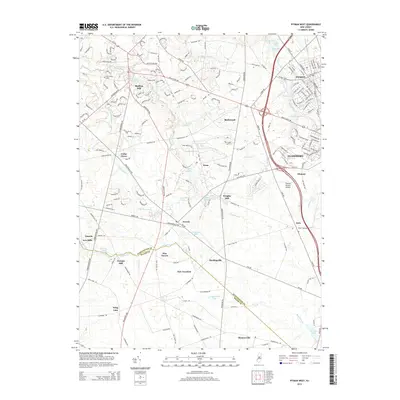
2014 Map of Pitman West
USGS Topo · Published 2014About this map
Mullica Hill and the academic hub of Glassboro anchor this survey of southern New Jersey, where the landscape transitions from established suburban centers to the agricultural fields of the Gloucester Co and Salem Co borderlands. The map highlights a network of mill sites that speak to the area's industrial past, including Wrights Mill, Jessups Mill, and Avis Mills. These locations, clustered along waterways like Oldmans Cr and Raccoon Cr, illustrate the early 19th-century reliance on hydraulic power before the expansion of modern roadways.
Find a feature on this map
69 named features on this map. Tap any name to fly to it.
Don’t see what you’re looking for? This feature index may not catch every label — zoom into the map to look around manually.
Map Details
Editions of this 2014 Pitman West Map
This is the sole edition of this map. No revisions or reprints were ever made.
Other maps of this area

1890 · Salem
USGS Topo · 1:62,500

1890 · Glassboro
USGS Topo · 1:62,500

1891 · Philadelphia
USGS Topo · 1:62,500

1894 · Chester
USGS Topo · 1:62,500

1894 · Philadelphia
USGS Topo · 1:62,500

1896 · Philadelphia
USGS Topo · 1:62,500

1896 · Chester
USGS Topo · 1:62,500

1898 · Salem
USGS Topo · 1:62,500

1898 · Glassboro
USGS Topo · 1:62,500

1898 · Chester
USGS Topo · 1:62,500