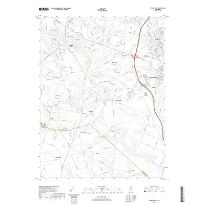
2019 Map of Pitman West
USGS Topo · Published 2019About this map
Mullica Hill and the neighboring boroughs of Pitman and Glassboro serve as the primary hubs in this modern topographic survey of Gloucester County. The landscape is defined by the headwaters of several critical drainages, where Raccoon Creek and Oldmans Cr wind through a patchwork of small crossroads communities and agricultural lands. Notable water features like Mullica Hill Pond, Kincaid Lake, and Wrights Millpond highlight the historic reliance on millponds throughout the region, while the southern reaches contain the uniquely named Elephant Swamp. The transition from the academic and industrial growth at the South Jersey Technology Park at Rowan University to the rural quiet of New Freedom and Monroeville illustrates the county's varied character. Genealogists may find value in the location of Mount Calvary Cem and the Richwood United Methodist Cem, alongside aviation history at the Thomas Browne Airpark.
Find a feature on this map
76 named features on this map. Tap any name to fly to it.
Don’t see what you’re looking for? This feature index may not catch every label — zoom into the map to look around manually.
Map Details
Editions of this 2019 Pitman West Map
This is the sole edition of this map. No revisions or reprints were ever made.
Other maps of this area

1890 · Salem
USGS Topo · 1:62,500

1890 · Glassboro
USGS Topo · 1:62,500

1891 · Philadelphia
USGS Topo · 1:62,500

1894 · Chester
USGS Topo · 1:62,500

1894 · Philadelphia
USGS Topo · 1:62,500

1896 · Philadelphia
USGS Topo · 1:62,500

1896 · Chester
USGS Topo · 1:62,500

1898 · Salem
USGS Topo · 1:62,500

1898 · Glassboro
USGS Topo · 1:62,500

1898 · Chester
USGS Topo · 1:62,500