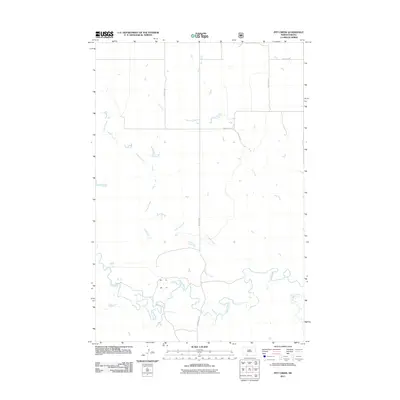
2011 Map of Pitt Creek
USGS Topo · Published 2011About this map
Crooked Creek and Pitt Creek wind through this rural Sioux County landscape, defining the drainage patterns of a region dominated by wide-open prairie and grazing lands. The map illustrates a grid of secondary roads such as 90th St SW and 58th Ave SW, which provide the primary access to this sparsely settled area. In the southern portion of the quadrangle, the terrain becomes more intricate where Cedar Creek and Timber Creek converge, creating complex riparian corridors. This 2011 survey by the U.S. Geological Survey reflects the enduring agricultural character of the Porcupine District, showing the intersection of Watauga Rd with the local section lines that have organized the Dakota territory since the early days of settlement.
Find a feature on this map
10 named features on this map. Tap any name to fly to it.
Don’t see what you’re looking for? This feature index may not catch every label — zoom into the map to look around manually.
Map Details
Editions of this 2011 Pitt Creek Map
This is the sole edition of this map. No revisions or reprints were ever made.
Other maps of this area

1953 · McIntosh
USGS Topo · 1:250,000

1954 · Bismarck
USGS Topo · 1:250,000

1958 · Bismarck
USGS Topo · 1:250,000

1958 · McIntosh
USGS Topo · 1:250,000

1971 · Lookout Butte
USGS Topo · 1:24,000

1972 · Paradise Flats
USGS Topo · 1:24,000

1972 · Wheeler Hills
USGS Topo · 1:24,000

1972 · Morristown
USGS Topo · 1:24,000

1972 · Watauga
USGS Topo · 1:24,000

1972 · Hump Butte
USGS Topo · 1:24,000