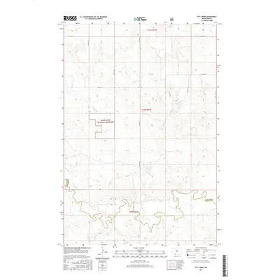
2017 Map of Pitt Creek
USGS Topo · Published 2017About this map
The Cedar River National Grassland dominates this portion of the northern plains, where the open landscape is defined by the winding paths of several ephemeral and perennial streams. Flowing through the rolling terrain, Pitt Cr and Crooked Cr join with Whitmore Cr as they navigate toward the southern portion of the quadrangle. The map captures the subtle drainage patterns of the high prairie, illustrating how water moving through Cedar Cr, Hay Cr, and Timber Cr has shaped the local topography over time.
Find a feature on this map
20 named features on this map. Tap any name to fly to it.
Don’t see what you’re looking for? This feature index may not catch every label — zoom into the map to look around manually.
Map Details
Editions of this 2017 Pitt Creek Map
This is the sole edition of this map. No revisions or reprints were ever made.
Other maps of this area

1953 · McIntosh
USGS Topo · 1:250,000

1954 · Bismarck
USGS Topo · 1:250,000

1958 · Bismarck
USGS Topo · 1:250,000

1958 · McIntosh
USGS Topo · 1:250,000

1971 · Lookout Butte
USGS Topo · 1:24,000

1972 · Paradise Flats
USGS Topo · 1:24,000

1972 · Wheeler Hills
USGS Topo · 1:24,000

1972 · Morristown
USGS Topo · 1:24,000

1972 · Watauga
USGS Topo · 1:24,000

1972 · Hump Butte
USGS Topo · 1:24,000