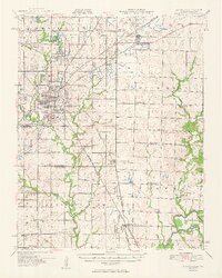
1950 Map of Pittsburg
USGS Topo · Published 1950About this map
Extensive Strip Mines define the landscape across the Kansas and Missouri border, reflecting the intensive coal industry of the mid-20th century. This 1950 survey highlights the dense industrial activity surrounding Pittsburg, where the Missouri Pacific and Kansas City Southern railroads converge to support the regional mining operations. Beyond the city center, a network of rural school districts like Gaskell Sch and Pleasant Valley Sch serves the farming and mining communities that occupy the hinterlands of Crawford and Jasper counties.
Find a feature on this map
93 named features on this map. Tap any name to fly to it.
Don’t see what you’re looking for? This feature index may not catch every label — zoom into the map to look around manually.
Map Details
Editions of this 1950 Pittsburg Map
2 editions found

Other maps of this area

1884 · Fort Scott
USGS Topo · 1:125,000

1886 · Nevada
USGS Topo · 1:125,000

1886 · Joplin
USGS Topo · 1:125,000

1886 · Fort Scott
USGS Topo · 1:125,000

1886 · Carthage
USGS Topo · 1:125,000

1893 · Fort Scott
USGS Topo · 1:125,000

1894 · Nevada
USGS Topo · 1:125,000

1894 · Joplin
USGS Topo · 1:125,000

1894 · Carthage
USGS Topo · 1:125,000

1918 · Columbus
USGS Topo · 1:62,500