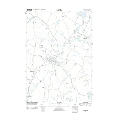
2012 Map of Pittsfield
USGS Topo · Published 2012About this map
The Suncook River winds through the heart of this Merrimack County landscape, anchoring a network of small settlements and agricultural landmarks. Local history is deeply etched into the terrain at sites like Websters Mill and the Pittsfield Fairgrounds, while the surrounding hills—including Catamount Mountain, Beauty Hill, and Sanborn Hill—define the area's physical character. For genealogists, the map provides precise locations for several burial grounds, such as Floral Park Cem, Riverview Cem, and the more secluded Berry Cem. The presence of Appleview Orchard and numerous ponds like Lougee Pond and Berry Pond suggest a landscape balanced between seasonal industry and the natural watershed. Roads such as Pancake Hill Rd and Coles Ledge Rd connect the primary village centers of Barnstead and Center Barnstead to the rural corners of the township.
Find a feature on this map
149 named features on this map. Tap any name to fly to it.
Don’t see what you’re looking for? This feature index may not catch every label — zoom into the map to look around manually.
Map Details
Editions of this 2012 Pittsfield Map
This is the sole edition of this map. No revisions or reprints were ever made.
Other maps of this area

1917 · Mt. Pawtuckaway
USGS Topo · 1:62,500

1919 · Mt. Pawtuckaway
USGS Topo · 1:62,500

1919 · Gilmanton
USGS Topo · 1:62,500

1919 · Alton
USGS Topo · 1:62,500

1921 · Suncook
USGS Topo · 1:62,500

1927 · Gilmanton
USGS Topo · 1:62,500

1939 · Mt. Pawtuckaway
USGS Topo · 1:62,500

1944 · Mt. Pawtuckaway
USGS Topo · 1:62,500

1944 · Suncook
USGS Topo · 1:62,500

1949 · Portland
USGS Topo · 1:250,000