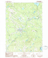
1987 Map of Pittsfield
USGS Topo · Published 1987About this map
The Suncook River winds through the heart of this Merrimack County landscape, anchoring the industrial and civic center of Pittsfield. By the late 1980s, the town's structural evolution is evident in features like the Sewage Treatment Plant and the lingering path of the Old Railroad Grade, which traces the valley's historic transportation corridor. To the north, the village of Barnstead and its neighboring Center Barnstead sit near the outflow of Lower Suncook Lake, reflecting a settlement pattern deeply tied to the regional water network.
Find a feature on this map
50 named features on this map. Tap any name to fly to it.
Don’t see what you’re looking for? This feature index may not catch every label — zoom into the map to look around manually.
Map Details
Editions of this 1987 Pittsfield Map
This is the sole edition of this map. No revisions or reprints were ever made.
Other maps of this area

1917 · Mt. Pawtuckaway
USGS Topo · 1:62,500

1919 · Mt. Pawtuckaway
USGS Topo · 1:62,500

1919 · Gilmanton
USGS Topo · 1:62,500

1919 · Alton
USGS Topo · 1:62,500

1921 · Suncook
USGS Topo · 1:62,500

1927 · Gilmanton
USGS Topo · 1:62,500

1939 · Mt. Pawtuckaway
USGS Topo · 1:62,500

1944 · Mt. Pawtuckaway
USGS Topo · 1:62,500

1944 · Suncook
USGS Topo · 1:62,500

1949 · Portland
USGS Topo · 1:250,000