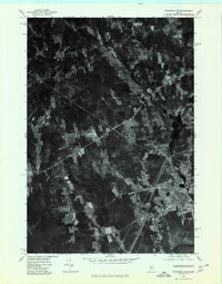
1975 Map of Pittsfield SW
USGS Topo · Published 1980About this map
Pittsfield anchors the southeastern corner of this mid-1970s orthophoto survey, where the winding path of the Sebasticook River carves through a landscape of dense woodland and expansive agricultural clearings. This hybrid visual record captures the transition from town center to rural crossroads, documenting the precise footprints of farmsteads and rural junctions such as West Palmyra and Mosher Corner. Unlike traditional topographic maps, this aerial imagery shows the exact density of forest cover and the intricate patterns of field cultivation at Emerson Corner, providing a literal view of the Somerset County countryside. The imagery reveals the established road network connecting these historic corners, offering a clear perspective on the land use and spatial organization of the region before late-twentieth-century developments.
Find a feature on this map
5 named features on this map. Tap any name to fly to it.
Don’t see what you’re looking for? This feature index may not catch every label — zoom into the map to look around manually.
Map Details
Editions of this 1975 Pittsfield SW Map
This is the sole edition of this map. No revisions or reprints were ever made.
Other maps of this area

1892 · Waterville
USGS Topo · 1:62,500

1913 · Skowhegan
USGS Topo · 1:62,500

1926 · Burnham
USGS Topo · 1:62,500

1930 · Pittsfield
USGS Topo · 1:48,000

1932 · Pittsfield
USGS Topo · 1:62,500

1933 · Pittsfield
USGS Topo · 1:62,500

1943 · Waterville
USGS Topo · 1:62,500

1948 · Bangor
USGS Topo · 1:250,000

1955 · Pittsfield
USGS Topo · 1:62,500

1955 · Skowhegan
USGS Topo · 1:62,500