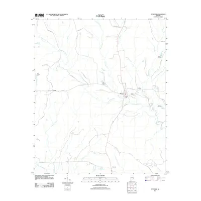
2011 Map of Pittsview
USGS Topo · Published 2011About this map
Pittsview and the surrounding Russell County rural landscape are defined by a network of dendritic waterways and small settlements. The area is anchored by the confluence of Hatchechubbee Creek and Weolustee Creek, which creates a complex drainage system across the coastal plain. Local life centers around the Pittsview Post Office and nearby Pittsview Cemetery, while the western edge is marked by the small community of Hooks. The presence of several private impoundments, such as B B Burts Dam and Balfore Lake Dam, alongside family-named roads like Perrys Well Rd and Lewis Grocery Rd, illustrates the deeply ingrained agricultural and residential patterns of this part of Alabama. To the south, the landscape transitions toward Glenville near the headwaters of Little Barbour Creek.
Find a feature on this map
51 named features on this map. Tap any name to fly to it.
Don’t see what you’re looking for? This feature index may not catch every label — zoom into the map to look around manually.
Map Details
Editions of this 2011 Pittsview Map
This is the sole edition of this map. No revisions or reprints were ever made.
Other maps of this area

1914 · Seale
USGS Topo · 1:62,500

1949 · Fort Mitchell
USGS Topo · 1:24,000

1950 · Seale
USGS Topo · 1:24,000

1950 · Seale
USGS Topo · 1:62,500

1955 · Seale
USGS Topo · 1:24,000
1955 · Fort Mitchell
USGS Topo · 1:24,000

1955 · Seale
USGS Topo · 1:62,500

1955 · Phenix City
USGS Topo · 1:250,000

1957 · Phenix City
USGS Topo · 1:250,000
1957 · Pittsview
USGS Topo · 1:24,000