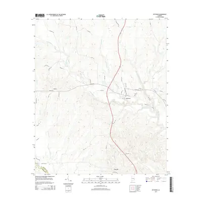
2014 Map of Pittsview
USGS Topo · Published 2014About this map
Pittsview serves as a central hub on this 2014 survey, where the Old Seale Hwy and Us-431 intersect near the Pittsview Cem. The landscape is defined by an intricate network of waterways, most notably the meandering Hatchechubbee Creek and its various tributaries like Woolustee Cr and Silver Run. To the west, the settlement of Hooks sits among landmarks such as Schoolhouse Br, while the southern reaches of the map transition into Barbour County near Glenville. This modern digital topographic study reveals the persistent rural character of the region, documenting family-named roads and natural features like Burts Lake and Comers Pond that have likely served as local landmarks for generations. The transition from Russell County to Barbour County is marked by the course of Little Barbour Cr and N Fork Cowikee Cr.
Find a feature on this map
56 named features on this map. Tap any name to fly to it.
Don’t see what you’re looking for? This feature index may not catch every label — zoom into the map to look around manually.
Map Details
Editions of this 2014 Pittsview Map
This is the sole edition of this map. No revisions or reprints were ever made.
Other maps of this area

1914 · Seale
USGS Topo · 1:62,500

1949 · Fort Mitchell
USGS Topo · 1:24,000

1950 · Seale
USGS Topo · 1:24,000

1950 · Seale
USGS Topo · 1:62,500

1955 · Seale
USGS Topo · 1:24,000
1955 · Fort Mitchell
USGS Topo · 1:24,000

1955 · Seale
USGS Topo · 1:62,500

1955 · Phenix City
USGS Topo · 1:250,000

1957 · Phenix City
USGS Topo · 1:250,000
1957 · Pittsview
USGS Topo · 1:24,000