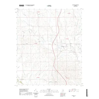
2020 Map of Pittsview
USGS Topo · Published 2020About this map
Hatchechubbee Creek and its many tributaries, including Watermelon Creek and Weolustee Creek, define the rolling drainage patterns of this corner of eastern Alabama. The settlement of Pittsview serves as a central point of interest, located near the Pittsview Cemetery and the intersection of Pittsview Highway. Further south, the map details the community of Glenville at the boundary of Russell County and Barbour County.
Find a feature on this map
59 named features on this map. Tap any name to fly to it.
Don’t see what you’re looking for? This feature index may not catch every label — zoom into the map to look around manually.
Map Details
Editions of this 2020 Pittsview Map
This is the sole edition of this map. No revisions or reprints were ever made.
Other maps of this area

1914 · Seale
USGS Topo · 1:62,500

1949 · Fort Mitchell
USGS Topo · 1:24,000

1950 · Seale
USGS Topo · 1:24,000

1950 · Seale
USGS Topo · 1:62,500

1955 · Seale
USGS Topo · 1:24,000
1955 · Fort Mitchell
USGS Topo · 1:24,000

1955 · Seale
USGS Topo · 1:62,500

1955 · Phenix City
USGS Topo · 1:250,000

1957 · Phenix City
USGS Topo · 1:250,000
1957 · Pittsview
USGS Topo · 1:24,000