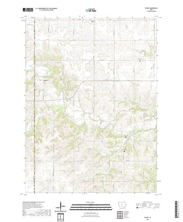
2022 Map of Pitzer
USGS Topo · Published 2022About this map
The Middle River winds through the rural landscape of Madison and Adair Counties, providing a central drainage for the rolling topography of this agricultural region. The small unincorporated settlements of Pitzer and Webster anchor the northern and western portions of the sheet, connected by a network of gravel and paved routes such as Co Rd P48 and Co Rd P53. This 2022 survey details a landscape where historic local life is marked by numerous family and community burial grounds, including Wintermantle Cem, Wight Cem, and Welty Cem.
Find a feature on this map
55 named features on this map. Tap any name to fly to it.
Don’t see what you’re looking for? This feature index may not catch every label — zoom into the map to look around manually.
Map Details
Editions of this 2022 Pitzer Map
This is the sole edition of this map. No revisions or reprints were ever made.
Other maps of this area

1951 · Afton
USGS Topo · 1:62,500

1952 · Winterset
USGS Topo · 1:62,500

1954 · Greenfield
USGS Topo · 1:62,500

1954 · Omaha
USGS Topo · 1:250,000

1957 · Omaha
USGS Topo · 1:250,000

1958 · Omaha
USGS Topo · 1:250,000

1981 · Zion
USGS Topo · 1:24,000
1983 · Earlham West
USGS Topo · 1:24,000
1983 · Stuart South
USGS Topo · 1:24,000
1983 · Pitzer
USGS Topo · 1:24,000