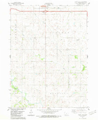
1983 Map of Stuart South
USGS Topo · Published 1984About this map
Stuart sits at the northern edge of this agricultural landscape, where the prairie begins its descent into the drainage basins of the North River and Middle River. This 1983 survey shows a region defined by established township boundaries including Jefferson, Lincoln, Grove, and Harrison. The presence of several rural landmarks, such as Mt Vernon Ch and Fairview Ch, indicates the enduring centers of these small farming communities. To the south and west, the terrain becomes more varied as Plunger Creek and Jim Creek carve through the land. Transportation infrastructure is represented by the heavy corridor of Highway 80 and local landmarks like Wasson Landing Strip. A small Quarry near the Middle River and several municipal Sew Disp Ponds illustrate the local industrial and utility footprint within this Adair County landscape.
Find a feature on this map
23 named features on this map. Tap any name to fly to it.
Don’t see what you’re looking for? This feature index may not catch every label — zoom into the map to look around manually.
Map Details
Editions of this 1983 Stuart South Map
This is the sole edition of this map. No revisions or reprints were ever made.
Other maps of this area

1949 · Adel
USGS Topo · 1:62,500

1951 · Adel
USGS Topo · 1:62,500

1952 · Panora
USGS Topo · 1:62,500

1952 · Winterset
USGS Topo · 1:62,500

1954 · Greenfield
USGS Topo · 1:62,500

1954 · Omaha
USGS Topo · 1:250,000

1957 · Omaha
USGS Topo · 1:250,000

1958 · Omaha
USGS Topo · 1:250,000
1982 · Redfield
USGS Topo · 1:24,000
1982 · Stuart North
USGS Topo · 1:24,000