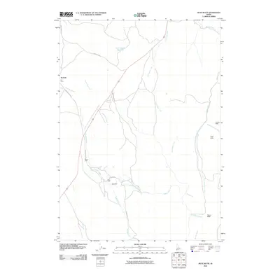
2010 Map of Piute Butte
USGS Topo · Published 2010About this map
Rockville sits along the western edge of this Owyhee County landscape, where the high desert terrain is defined by dramatic volcanic features and essential water management. The topography is anchored by prominent elevations including Piute Butte, Squaw Butte, and Dryden Peak, while the northern portion is marked by the unique formation known as The Rocks. Ranching and water rights define the human imprint on the land, evidenced by Bush Ranch and the presence of both Brown Dam and King Dam along the drainage of McBride Creek. A network of unpaved tracks such as Sands Basin Rd and Chipmunk Rd connect these isolated outposts. The drainage system is particularly intricate, featuring the West Fork and East Fork of Squaw Creek, alongside Little Squaw Creek and the Canter Spring Reservoir, all crucial for supporting life in this arid environment.
Find a feature on this map
21 named features on this map. Tap any name to fly to it.
Don’t see what you’re looking for? This feature index may not catch every label — zoom into the map to look around manually.
Map Details
Editions of this 2010 Piute Butte Map
This is the sole edition of this map. No revisions or reprints were ever made.
Other maps of this area

1892 · Silver City
USGS Topo · 1:125,000

1894 · Silver City
USGS Topo · 1:125,000

1898 · Silver City
USGS Topo · 1:125,000

1955 · Boise
USGS Topo · 1:250,000

1957 · Opalene Gulch
USGS Topo · 1:24,000

1957 · Sands Basin
USGS Topo · 1:62,500

1958 · Boise
USGS Topo · 1:250,000

1962 · Boise
USGS Topo · 1:250,000

1965 · Rooster Comb Peak
USGS Topo · 1:62,500

1967 · Rockville
USGS Topo · 1:24,000