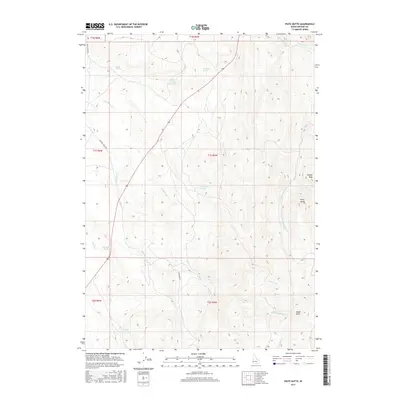
2017 Map of Piute Butte
USGS Topo · Published 2017About this map
Piute Butte and Squaw Butte anchor this high-desert landscape in Owyhee County, where the terrain is defined by a network of drainage forks and scattered water sources. The map reveals a reliance on isolated springs, such as Skull Spring, Johnstone Spring, and Blackstock Spring, which supported livestock and transit through this arid interior. In the northern reaches, the Canter Spring Reservoir represents a significant man-made effort to manage the limited water supply.
Find a feature on this map
27 named features on this map. Tap any name to fly to it.
Don’t see what you’re looking for? This feature index may not catch every label — zoom into the map to look around manually.
Map Details
Editions of this 2017 Piute Butte Map
This is the sole edition of this map. No revisions or reprints were ever made.
Other maps of this area

1892 · Silver City
USGS Topo · 1:125,000

1894 · Silver City
USGS Topo · 1:125,000

1898 · Silver City
USGS Topo · 1:125,000

1955 · Boise
USGS Topo · 1:250,000

1957 · Opalene Gulch
USGS Topo · 1:24,000

1957 · Sands Basin
USGS Topo · 1:62,500

1958 · Boise
USGS Topo · 1:250,000

1962 · Boise
USGS Topo · 1:250,000

1965 · Rooster Comb Peak
USGS Topo · 1:62,500

1967 · Rockville
USGS Topo · 1:24,000