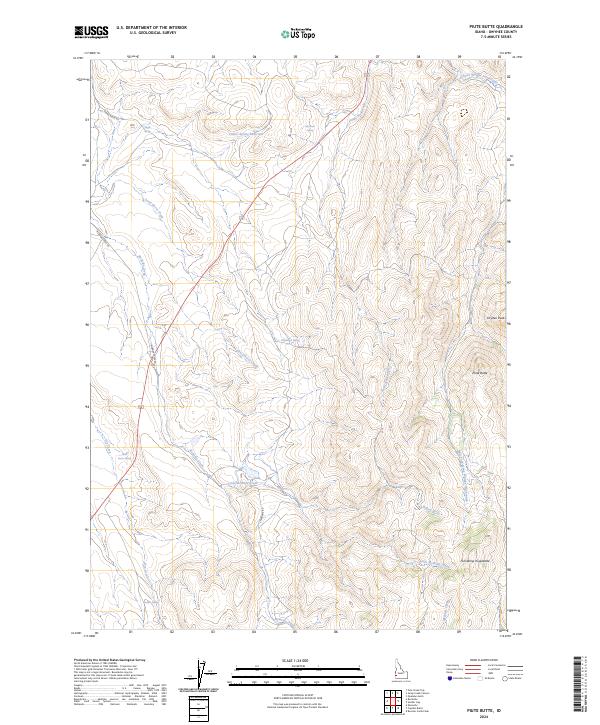
2024 Map of Piute Butte
USGS Topo · Published 2024About this map
Piute Butte and Dryden Peak rise above the high-desert landscape of Owyhee County, defining a region where water management and indigenous naming are central to the geography. This modern survey illustrates a network of essential water sources, such as Canter Spring Reservoir, Skull Spring, and Blackstock Spring, which support the arid uplands. The nomenclature of the area reflects deep cultural layers, evidenced by the presence of Newe Waippe Naokwaide and Paide Naokwaide alongside traditional drainage names like Dead Horse Creek. The road network is sparse but vital, with Sands Basin Rd and McBride Creek Rd following the natural contours of the land. Cattle-country infrastructure is visible through numerous named springs and the seasonal flow of Little McBride Creek and Willow Fork, providing a contemporary view of this rangeland's hydrology.
Find a feature on this map
26 named features on this map. Tap any name to fly to it.
Don’t see what you’re looking for? This feature index may not catch every label — zoom into the map to look around manually.
Map Details
Editions of this 2024 Piute Butte Map
This is the sole edition of this map. No revisions or reprints were ever made.
Other maps of this area

1892 · Silver City
USGS Topo · 1:125,000

1894 · Silver City
USGS Topo · 1:125,000

1898 · Silver City
USGS Topo · 1:125,000

1955 · Boise
USGS Topo · 1:250,000

1957 · Opalene Gulch
USGS Topo · 1:24,000

1957 · Sands Basin
USGS Topo · 1:62,500

1958 · Boise
USGS Topo · 1:250,000

1962 · Boise
USGS Topo · 1:250,000

1965 · Rooster Comb Peak
USGS Topo · 1:62,500

1967 · Rockville
USGS Topo · 1:24,000