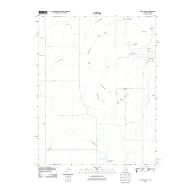
2011 Map of Piute Knoll
USGS Topo · Published 2011About this map
Mining operations and intermittent drainages define this San Juan County landscape, where the extraction of minerals has left a dense network of named sites across the high desert. Numerous prospects such as the Deremo Mine Number 1, Silver Bell Mine, and Calliham Mine are clustered near canyons and plateaus, reflecting the region's industrial heritage. The terrain is marked by significant features like Piute Knoll and East Summit, with water management evidenced by the Snyder Reservoir Number Two and its associated dam. This network of small-scale mines, including the Last Hope Mine and Bluebird Mine, suggests a period of intensive geological exploration. A grid of local roads like W Summit Rd and Ucolo Rd provides access to these remote operations, connecting the various canyons such as East Canyon and Summit Canyon that cut through the plateau.
Find a feature on this map
54 named features on this map. Tap any name to fly to it.
Don’t see what you’re looking for? This feature index may not catch every label — zoom into the map to look around manually.
Map Details
Editions of this 2011 Piute Knoll Map
This is the sole edition of this map. No revisions or reprints were ever made.
Other maps of this area

1885 · La Sal
USGS Topo · 1:250,000

1886 · Abajo
USGS Topo · 1:250,000

1892 · Abajo
USGS Topo · 1:250,000

1893 · Abajo
USGS Topo · 1:250,000

1916 · Paradox Valley
USGS Topo · 1:125,000

1922 · Paradox Valley
USGS Topo · 1:125,000

1948 · Horse Range Mesa
USGS Topo · 1:24,000

1949 · Egnar
USGS Topo · 1:24,000

1950 · Horse Range Mesa
USGS Topo · 1:24,000

1950 · Egnar
USGS Topo · 1:24,000