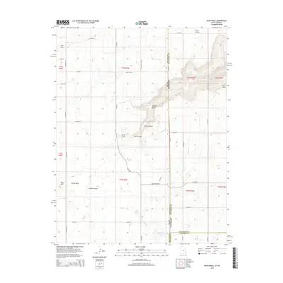
2014 Map of Piute Knoll
USGS Topo · Published 2014About this map
Piute Knoll anchors a high desert landscape along the border of Utah and Colorado, where San Juan County meets San Miguel and Dolores counties. This high plateau is carved by an intricate network of drainages, including Wildhorse Canyon, Rustler Canyon, and Coal Bed Canyon. The reliance on local water sources is evident through the naming of numerous natural points such as Rustler Spring, Secret Springs, and Piute Spring, alongside the man-made Snyder Reservoir Number Two. Rural transport routes like Ucolo Rd and Egnar Cutoff Rd provide access through the complex topography of Pearson Wash and Hickman Flt. The map reflects a remote ranching or resource-focused area defined by its harsh geography and the transition from the high points of Bishop Point and East Summit down into the canyon systems.
Find a feature on this map
51 named features on this map. Tap any name to fly to it.
Don’t see what you’re looking for? This feature index may not catch every label — zoom into the map to look around manually.
Map Details
Editions of this 2014 Piute Knoll Map
This is the sole edition of this map. No revisions or reprints were ever made.
Other maps of this area

1885 · La Sal
USGS Topo · 1:250,000

1886 · Abajo
USGS Topo · 1:250,000

1892 · Abajo
USGS Topo · 1:250,000

1893 · Abajo
USGS Topo · 1:250,000

1916 · Paradox Valley
USGS Topo · 1:125,000

1922 · Paradox Valley
USGS Topo · 1:125,000

1948 · Horse Range Mesa
USGS Topo · 1:24,000

1949 · Egnar
USGS Topo · 1:24,000

1950 · Horse Range Mesa
USGS Topo · 1:24,000

1950 · Egnar
USGS Topo · 1:24,000