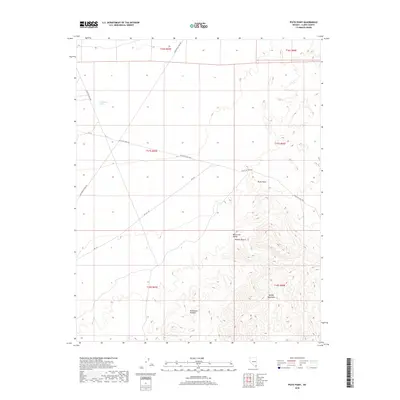
2018 Map of Piute Point
USGS Topo · Published 2018About this map
Valley of Fire Hwy cuts across this arid landscape, following a corridor between the high ground of Piute Point and the complex topography of the Muddy Mountains. This survey reveals a transition in the Mojave Desert terrain where the California Wash drainage system interacts with the geological formations of Monocline Valley. The presence of the Old Spanish Trail Rd in the northern sections speaks to the deep-rooted transit history of this region, which has long relied on these specific desert passes. To the south, the intricate contours of the Buffington Pockets demonstrate the erosion patterns and natural catchment areas that characterize this part of Clark County, providing a high-resolution look at the land before modern development expanded through the neighboring valleys.
Find a feature on this map
16 named features on this map. Tap any name to fly to it.
Don’t see what you’re looking for? This feature index may not catch every label — zoom into the map to look around manually.
Map Details
Editions of this 2018 Piute Point Map
This is the sole edition of this map. No revisions or reprints were ever made.
Other maps of this area

1886 · Saint Thomas
USGS Topo · 1:250,000

1893 · Saint Thomas
USGS Topo · 1:250,000

1926 · Boulder Canyon
USGS Topo · 1:96,000

1952 · Dry Lake
USGS Topo · 1:62,500

1953 · Muddy Peak
USGS Topo · 1:62,500

1954 · Las Vegas
USGS Topo · 1:250,000

1957 · Las Vegas
USGS Topo · 1:250,000

1958 · Arrow Canyon
USGS Topo · 1:62,500

1958 · Moapa
USGS Topo · 1:62,500

1959 · Las Vegas
USGS Topo · 1:250,000