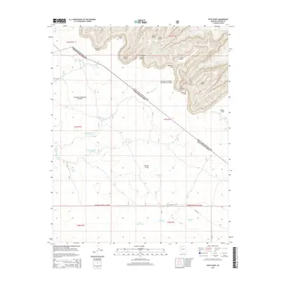
2014 Map of Piute Point
USGS Topo · Published 2014About this map
Piute Point stands as a prominent overlook in this high-desert landscape where the Grand Canyon National Park meets the Kaibab National Forest. The geography is defined by profound vertical relief, featuring dramatic monuments like Pollux Temple, Diana Temple, and Vesta Temple that rise above deeply incised drainages. The map traces the intricate contours of Turquoise Canyon, Sapphire Canyon, and Agate Canyon as they descend toward the Granite Gorge. Water management in this arid environment is evidenced by a network of catchments and tanks, such as Sevenmile Tank, Midway Number One Tank, and Ike Smith Tank. These features, along with historic routes like the Supai Village Old 328 Rd, reflect the intersection of traditional paths and modern federal land management within Coconino County.
Find a feature on this map
44 named features on this map. Tap any name to fly to it.
Don’t see what you’re looking for? This feature index may not catch every label — zoom into the map to look around manually.
Map Details
Editions of this 2014 Piute Point Map
This is the sole edition of this map. No revisions or reprints were ever made.
Other maps of this area

1886 · Chino
USGS Topo · 1:250,000

1886 · Kaibab
USGS Topo · 1:250,000

1891 · Chino
USGS Topo · 1:250,000

1903 · Bright Angel
USGS Topo · 1:48,000

1906 · Bright Angel
USGS Topo · 1:48,000

1948 · Williams
USGS Topo · 1:250,000

1953 · Grand Canyon
USGS Topo · 1:250,000

1954 · Williams
USGS Topo · 1:250,000

1956 · Williams
USGS Topo · 1:250,000

1957 · Grand Canyon
USGS Topo · 1:250,000