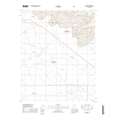
2018 Map of Piute Point
USGS Topo · Published 2018About this map
Grand Canyon National Park and Kaibab National Forest dominate this high-desert landscape, where the plateaus are carved by dramatic geological formations. The northern portion is defined by prominent natural monuments including Pollux Temple, Vesta Temple, and Diana Temple, set against the deep recesses of Agate Canyon and Sapphire Canyon. This terrain transition is marked by lookout points such as Piute Point and Jicarilla Point, which overlook the sheer drops into Granite Gorge. Water management for livestock and wildlife is evident across the drier southern reaches, where a network of remote basins like Sevenmile Tank, Homestead Tank, and Sheep Tank dot the forest. Old forest and park access routes, including Supai Village Old "328 Rd and Old "2500" Rd, provide a record of historical movement through these remote canyons and plateaus.
Find a feature on this map
44 named features on this map. Tap any name to fly to it.
Don’t see what you’re looking for? This feature index may not catch every label — zoom into the map to look around manually.
Map Details
Editions of this 2018 Piute Point Map
This is the sole edition of this map. No revisions or reprints were ever made.
Other maps of this area

1886 · Chino
USGS Topo · 1:250,000

1886 · Kaibab
USGS Topo · 1:250,000

1891 · Chino
USGS Topo · 1:250,000

1903 · Bright Angel
USGS Topo · 1:48,000

1906 · Bright Angel
USGS Topo · 1:48,000

1948 · Williams
USGS Topo · 1:250,000

1953 · Grand Canyon
USGS Topo · 1:250,000

1954 · Williams
USGS Topo · 1:250,000

1956 · Williams
USGS Topo · 1:250,000

1957 · Grand Canyon
USGS Topo · 1:250,000