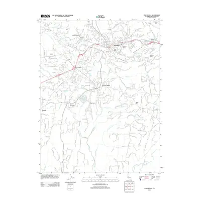
2012 Map of Placerville
USGS Topo · Published 2012About this map
Placerville and its neighboring gold-country settlements are documented here in detail, revealing a landscape where 19th-century mining history meets 21st-century growth. The map centers on the historic hub of the California Mother Lode, bounded by terrain features like Sacramento Hill and Texas Hill. The density of cemeteries, such as Westwood Hills Memorial Cem and the Bennett Memorial Park Catholic Cem, provides a significant record for genealogical research in El Dorado County.
Find a feature on this map
207 named features on this map. Tap any name to fly to it.
Don’t see what you’re looking for? This feature index may not catch every label — zoom into the map to look around manually.
Map Details
Editions of this 2012 Placerville Map
This is the sole edition of this map. No revisions or reprints were ever made.
Other maps of this area

1891 · Placerville
USGS Topo · 1:125,000

1892 · Placerville
USGS Topo · 1:125,000

1893 · Placerville
USGS Topo · 1:125,000

1947 · Sacramento
USGS Topo · 1:250,000

1948 · Sacramento
USGS Topo · 1:250,000

1949 · Georgetown
USGS Topo · 1:62,500

1949 · Placerville
USGS Topo · 1:62,500

1949 · Placerville
USGS Topo · 1:24,000
1949 · Coloma
USGS Topo · 1:24,000
1949 · Latrobe
USGS Topo · 1:24,000