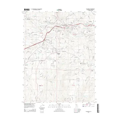
2015 Map of Placerville
USGS Topo · Published 2015About this map
Placerville and its surrounding foothills are mapped here during a period of sustained modern development along the historic Gold Country corridor. The city is characterized by a dense network of residential streets and essential community landmarks, including the Westwood Hills Memorial Cemetery and the Placerville Airport on Texas Hill. Evidence of the region’s critical water management infrastructure is visible through the winding path of the El Dorado Irrigation Main Canal.
Find a feature on this map
218 named features on this map. Tap any name to fly to it.
Don’t see what you’re looking for? This feature index may not catch every label — zoom into the map to look around manually.
Map Details
Editions of this 2015 Placerville Map
This is the sole edition of this map. No revisions or reprints were ever made.
Other maps of this area

1891 · Placerville
USGS Topo · 1:125,000

1892 · Placerville
USGS Topo · 1:125,000

1893 · Placerville
USGS Topo · 1:125,000

1947 · Sacramento
USGS Topo · 1:250,000

1948 · Sacramento
USGS Topo · 1:250,000

1949 · Georgetown
USGS Topo · 1:62,500

1949 · Placerville
USGS Topo · 1:62,500

1949 · Placerville
USGS Topo · 1:24,000
1949 · Coloma
USGS Topo · 1:24,000
1949 · Latrobe
USGS Topo · 1:24,000