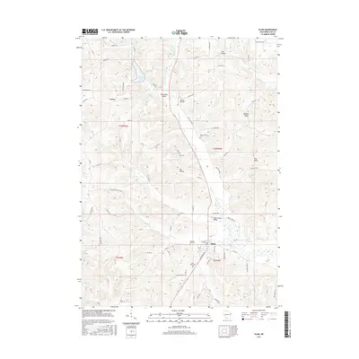
2016 Map of Plain
USGS Topo · Published 2016About this map
The village of Plain serves as the focal point for this Sauk County landscape, where the town grid meets the winding courses of Honey Cr and its tributaries. To the north, the terrain is defined by a series of distinct valleys that shaped local settlement patterns, including Shannahan Valley, Lins Valley, and the aptly named Sandpit Valley. The man-made White Mound Lake provides a significant water feature near the hilltop landmark of White Mound. Genealogists will find several key burial sites across the township, from the centrally located Saint Lukes Cem and Pleasant Hill Cem near the village to the more isolated Whitemound Cem further north. The map also captures the smaller settlement of Loreta, situated among the complex network of hollows like Big Hollow and Nachreiner Hollow Rd, illustrating the persistence of early agricultural communities.
Find a feature on this map
71 named features on this map. Tap any name to fly to it.
Don’t see what you’re looking for? This feature index may not catch every label — zoom into the map to look around manually.
Map Details
Editions of this 2016 Plain Map
This is the sole edition of this map. No revisions or reprints were ever made.
Other maps of this area

1901 · Denzer
USGS Topo · 1:62,500

1905 · Richland Center
USGS Topo · 1:125,000

1920 · Blue Mounds
USGS Topo · 1:62,500

1922 · Blue Mounds
USGS Topo · 1:62,500

1957 · Madison
USGS Topo · 1:250,000

1958 · North Freedom
USGS Topo · 1:62,500

1958 · La Crosse
USGS Topo · 1:250,000

1960 · Madison
USGS Topo · 1:250,000

1960 · Plain
USGS Topo · 1:62,500

1960 · Spring Green
USGS Topo · 1:62,500