
1960 Map of Plain
USGS Topo · Published 1961About this map
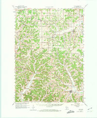
Deep-cut valleys and upland plateaus define this region of Sauk and Richland counties at the start of the 1960s. The settlement at Plain serves as a southern anchor, while Lime Ridge and Loganville dot the northern reaches. The landscape is intensely dissected by a network of hollows, such as Durst Hollow and McGlynn Hollow, which channel drainage into watercourses like Willow Creek and Honey Creek.
Find a feature on this map
83 named features on this map. Tap any name to fly to it.
Don’t see what you’re looking for? This feature index may not catch every label — zoom into the map to look around manually.
Map Details
Editions of this 1960 Plain Map
2 editions found
Other maps of this area

1901 · Denzer
USGS Topo · 1:62,500

1901 · The Dells
USGS Topo · 1:62,500

1905 · Richland Center
USGS Topo · 1:125,000

1920 · Blue Mounds
USGS Topo · 1:62,500

1922 · Blue Mounds
USGS Topo · 1:62,500

1927 · Hillsboro
USGS Topo · 1:62,500

1956 · Reedsburg
USGS Topo · 1:62,500

1957 · Wisconsin Dells
USGS Topo · 1:62,500

1957 · Madison
USGS Topo · 1:250,000

1958 · North Freedom
USGS Topo · 1:62,500