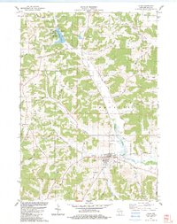
1983 Map of Plain
USGS Topo · Published 1983About this map
Plain serves as the primary hub of this landscape in the early 1980s, characterized by its grid of residential streets, a municipal Sew Disp plant, and the prominent St Anna Shrine. The surrounding terrain of the Franklin township is deeply carved by valleys and ridges, with drainage flowing through the Sugar Grove Valley and along the winding Honey Creek. Evidence of local industry and resource extraction is visible in several scattered Quarry and Quarries locations, particularly near the northern boundary. To the northwest, White Mound County Park surrounds White Mound Lake, featuring a White Mound Campground and a public Boat Ramp. Genealogists will find several burial grounds across the township, including St Lukes Cem south of the village and the more isolated Whitemound Cem located near the eponymous White Mound landmark.
Find a feature on this map
49 named features on this map. Tap any name to fly to it.
Don’t see what you’re looking for? This feature index may not catch every label — zoom into the map to look around manually.
Map Details
Editions of this 1983 Plain Map
This is the sole edition of this map. No revisions or reprints were ever made.
Other maps of this area

1901 · Denzer
USGS Topo · 1:62,500

1905 · Richland Center
USGS Topo · 1:125,000

1920 · Blue Mounds
USGS Topo · 1:62,500

1922 · Blue Mounds
USGS Topo · 1:62,500

1957 · Madison
USGS Topo · 1:250,000

1958 · North Freedom
USGS Topo · 1:62,500

1958 · La Crosse
USGS Topo · 1:250,000

1960 · Madison
USGS Topo · 1:250,000

1960 · Plain
USGS Topo · 1:62,500

1960 · Spring Green
USGS Topo · 1:62,500