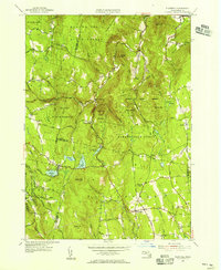
1955 Map of Plainfield
USGS Topo · Published 1956About this map
The northern Berkshires and the high ridges of Hampshire and Franklin counties converge here, defined by an intricate network of state forests and upland settlements. Plainfield sits as a central hub, connected to outlying hamlets like West Hawley and South Hawley via winding mountain roads. The landscape is dominated by the sprawling reaches of the Mohawk Trail State Forest, Savoy State Forest, and Hawley State Forest, which preserve the rugged character of the Hoosac Range.
Find a feature on this map
83 named features on this map. Tap any name to fly to it.
Don’t see what you’re looking for? This feature index may not catch every label — zoom into the map to look around manually.
Map Details
Editions of this 1955 Plainfield Map
4 editions found
Other maps of this area

1886 · Greylock
USGS Topo · 1:62,500

1886 · Hawley
USGS Topo · 1:62,500

1886 · Chesterfield
USGS Topo · 1:62,500

1886 · Becket
USGS Topo · 1:62,500

1888 · Becket
USGS Topo · 1:62,500

1888 · Chesterfield
USGS Topo · 1:62,500

1890 · Hawley
USGS Topo · 1:62,500

1891 · Greylock
USGS Topo · 1:62,500

1893 · Chesterfield
USGS Topo · 1:62,500

1893 · Becket
USGS Topo · 1:62,500