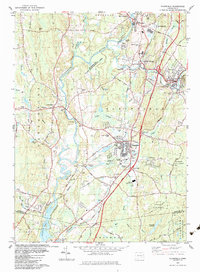
1983 Map of Plainfield
USGS Topo · Published 1983About this map
The Quinebaug River winds through this 1983 landscape, serving as a geographic anchor for the industrial and residential corridors of Plainfield, Wauregan, and Moosup. The region's development is clearly defined by its transportation and industrial infrastructure, from the Conrail lines and Wauregan Station to the modern freeway interchanges. This era shows a transition in land use, where established manufacturing centers like Central Village sit adjacent to the expanding Quinebaug State Management Area.
Find a feature on this map
69 named features on this map. Tap any name to fly to it.
Don’t see what you’re looking for? This feature index may not catch every label — zoom into the map to look around manually.
Map Details
Editions of this 1983 Plainfield Map
3 editions found
Other maps of this area

1889 · Putnam
USGS Topo · 1:62,500

1889 · Moosup
USGS Topo · 1:62,500

1892 · Woodstock
USGS Topo · 1:62,500

1892 · Norwich
USGS Topo · 1:62,500

1893 · Putnam
USGS Topo · 1:62,500

1893 · Moosup
USGS Topo · 1:62,500

1919 · Putnam
USGS Topo · 1:62,500

1920 · Moosup
USGS Topo · 1:62,500

1921 · Woodstock
USGS Topo · 1:62,500
1943 · Voluntown
USGS Topo · 1:31,680