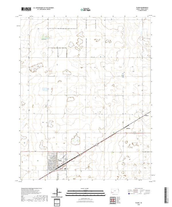
2022 Map of Plains
USGS Topo · Published 2022About this map
The town of Plains serves as the primary hub in this southwestern Kansas landscape, oriented around a grid that includes Park Ave, Ohio St, and Indiana. The settlement's infrastructure is anchored by the Plains Municipal Airport and the Plains Cem located just south of the main residential area. This region of Meade County is defined by its extensive section-line road network, where alphabetically named routes like H Rd and P Rd carve the high plains into a precise agricultural patchwork. Natural drainage and depression features are scarce, though Wildhorse Lake and the upper reaches of Spring Cr provide distinct hydrological breaks in the upland terrain. Smaller designated localities such as Hobart and Collano appear along the northeastern transportation corridors, marking historical points of interest for local researchers tracing the evolution of these prairie communities.
Find a feature on this map
30 named features on this map. Tap any name to fly to it.
Don’t see what you’re looking for? This feature index may not catch every label — zoom into the map to look around manually.
Map Details
Editions of this 2022 Plains Map
This is the sole edition of this map. No revisions or reprints were ever made.
Other maps of this area

1892 · Meade
USGS Topo · 1:125,000

1955 · Dodge City
USGS Topo · 1:250,000

1958 · Dodge City
USGS Topo · 1:250,000

1959 · Dodge City
USGS Topo · 1:250,000

1963 · Plains
USGS Topo · 1:24,000

1963 · Kismet NE
USGS Topo · 1:24,000

1963 · Lake Larrabee
USGS Topo · 1:24,000

1963 · Missler
USGS Topo · 1:24,000

1967 · Plains NE
USGS Topo · 1:24,000

1968 · Plains SW
USGS Topo · 1:24,000