
1968 Map of Plains SW
USGS Topo · Published 1969About this map
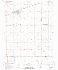
Morris, Fargo, and Mertilla townships define the open high plains of Southwest Kansas in this late 1960s survey. The landscape is marked by the boundary between Seward Co and Meade Co, where a sparse agricultural and industrial network emerges. Evidence of the region's energy economy is visible through multiple Oil Wells and a Drill Hole in the western sections, while a major Pipeline cuts diagonally across the northern portion of the quadrangle. The terrain, documented as West Plains, is characterized by scattered depressions and intermittent water features typical of the High Plains, illustrating the rural character of the area before modern intensified development. This map serves as a primary record of the infrastructure and land divisions in a period when planetable surveys were still being used to refine the topography of the Kansas panhandle region.
Find a feature on this map
9 named features on this map. Tap any name to fly to it.
Don’t see what you’re looking for? This feature index may not catch every label — zoom into the map to look around manually.
Map Details
Editions of this 1968 Plains SW Map
This is the sole edition of this map. No revisions or reprints were ever made.
Other maps of this area

1955 · Dodge City
USGS Topo · 1:250,000

1958 · Dodge City
USGS Topo · 1:250,000

1959 · Dodge City
USGS Topo · 1:250,000

1963 · Plains
USGS Topo · 1:24,000

1963 · Kismet NE
USGS Topo · 1:24,000

1967 · Plains NE
USGS Topo · 1:24,000

1968 · Plains NW
USGS Topo · 1:24,000

1968 · Liberal NE
USGS Topo · 1:24,000

1968 · Sublette SE
USGS Topo · 1:24,000
1968 · Sublette
USGS Topo · 1:24,000