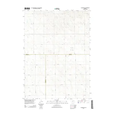
2014 Map of Plainview NE
USGS Topo · Published 2014About this map
Spring Cr and Breslau Cr define the drainage of this rural landscape where the boundaries of three Nebraska counties meet. Surveyed in 2014, the map reveals a meticulous grid of section roads, including 870 Rd and 535 Ave, which provide the backbone for agricultural transit across the plains. This particular area serves as a significant geographic intersection, marking the shared lines of Knox, Antelope, and Pierce counties. The terrain is characterized by subtle elevation changes and the winding paths of the local creeks, illustrating the persistent watercourses that have guided regional land use and property boundaries since the early days of settlement. It is an essential document for understanding the modern rural layout of these three neighboring counties.
Find a feature on this map
23 named features on this map. Tap any name to fly to it.
Don’t see what you’re looking for? This feature index may not catch every label — zoom into the map to look around manually.
Map Details
Editions of this 2014 Plainview NE Map
This is the sole edition of this map. No revisions or reprints were ever made.
Other maps of this area

1955 · Sioux City
USGS Topo · 1:250,000

1958 · Sioux City
USGS Topo · 1:250,000

1959 · Sioux City
USGS Topo · 1:250,000

1963 · Plainview
USGS Topo · 1:24,000

1963 · Brunswick
USGS Topo · 1:24,000

1963 · Foster
USGS Topo · 1:24,000

1974 · Midland
USGS Topo · 1:24,000
1974 · Center West
USGS Topo · 1:24,000
1974 · Creighton
USGS Topo · 1:24,000

1974 · Bloomfield
USGS Topo · 1:24,000