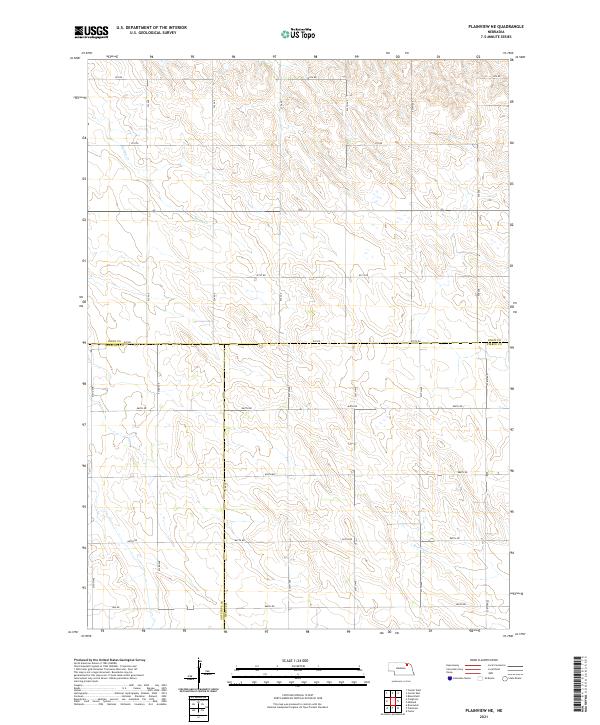
2021 Map of Plainview NE
USGS Topo · Published 2021About this map
Knox County agricultural lands dominate this landscape, where the confluence of three Nebraska counties creates a distinct geopolitical boundary. The map captures the intersection where Knox Co Antelope Co, Knox Co Pierce Co, and Antelope Co Pierce Co meet, a point of interest for researchers of local land records and regional history. The terrain is defined by the winding course of Spring Cr in the northwest and Breslau Cr in the southeast, which provide the primary drainage for the surrounding fields.
Find a feature on this map
29 named features on this map. Tap any name to fly to it.
Don’t see what you’re looking for? This feature index may not catch every label — zoom into the map to look around manually.
Map Details
Editions of this 2021 Plainview NE Map
This is the sole edition of this map. No revisions or reprints were ever made.
Other maps of this area

1955 · Sioux City
USGS Topo · 1:250,000

1958 · Sioux City
USGS Topo · 1:250,000

1959 · Sioux City
USGS Topo · 1:250,000

1963 · Plainview
USGS Topo · 1:24,000

1963 · Brunswick
USGS Topo · 1:24,000

1963 · Foster
USGS Topo · 1:24,000

1974 · Midland
USGS Topo · 1:24,000
1974 · Center West
USGS Topo · 1:24,000
1974 · Creighton
USGS Topo · 1:24,000

1974 · Bloomfield
USGS Topo · 1:24,000