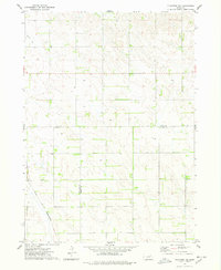
1974 Map of Plainview NE
USGS Topo · Published 1978About this map
Agricultural lands at the convergence of three Nebraska counties define this mid-1970s landscape. The terrain is marked by a complex network of sections and section lines where Knox, Antelope, and Pierce counties meet. This rural expanse is bisected in the southwest by the Chicago and North Western railroad, which cuts a diagonal path across the grid-patterned fields. Evidence of local water resources and land use appears in the form of Spring Cr in the northwest and numerous well sites distributed throughout the quadrangle, illustrating the importance of groundwater for the region's farming operations during this era.
Find a feature on this map
6 named features on this map. Tap any name to fly to it.
Don’t see what you’re looking for? This feature index may not catch every label — zoom into the map to look around manually.
Map Details
Editions of this 1974 Plainview NE Map
This is the sole edition of this map. No revisions or reprints were ever made.
Other maps of this area

1955 · Sioux City
USGS Topo · 1:250,000

1958 · Sioux City
USGS Topo · 1:250,000

1959 · Sioux City
USGS Topo · 1:250,000

1963 · Plainview
USGS Topo · 1:24,000

1963 · Brunswick
USGS Topo · 1:24,000

1963 · Foster
USGS Topo · 1:24,000

1974 · Midland
USGS Topo · 1:24,000
1974 · Center West
USGS Topo · 1:24,000
1974 · Creighton
USGS Topo · 1:24,000

1974 · Bloomfield
USGS Topo · 1:24,000