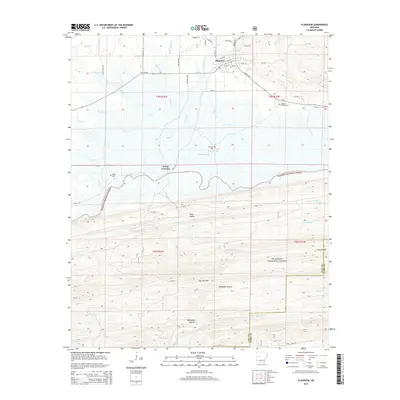
2014 Map of Plainview
USGS Topo · Published 2014About this map
Plainview sits at the northern edge of the Ouachita National Forest, serving as a gateway between the agricultural flats of Prairie Creek and the dense timberlands to the south. This 2014 survey documents a landscape defined by the drainage systems of Nimrod Lake, including Wilson Slough and Gilkey Creek. The map provides significant detail for genealogists, identifying localized burial grounds such as Barnett Chapel Cem and Sunlight Cem, which are tucked away from the main thoroughfares of Ar-60 and E Ar 28 HWY.
Find a feature on this map
64 named features on this map. Tap any name to fly to it.
Don’t see what you’re looking for? This feature index may not catch every label — zoom into the map to look around manually.
Map Details
Editions of this 2014 Plainview Map
This is the sole edition of this map. No revisions or reprints were ever made.
Other maps of this area

1888 · Dardanelle #4
USGS Topo · 1:62,500

1888 · Dardanelle #3
USGS Topo · 1:62,500

1890 · Hot Springs
USGS Topo · 1:125,000

1890 · Dardanelle
USGS Topo · 1:125,000

1894 · Hot Springs
USGS Topo · 1:125,000

1955 · Little Rock
USGS Topo · 1:250,000

1956 · Little Rock
USGS Topo · 1:250,000

1956 · Russellville
USGS Topo · 1:250,000

1960 · Little Rock
USGS Topo · 1:250,000

1964 · Russellville
USGS Topo · 1:250,000