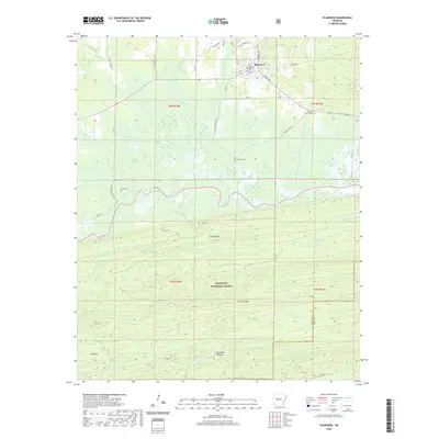
2020 Map of Plainview
USGS Topo · Published 2020About this map
Plainview serves as the primary hub of activity, where a grid of streets including W Main and N Spring Ave meets the surrounding timberlands and agricultural valleys. The landscape is sharply divided between the northern lowlands, defined by drainage networks like Sully Spring Br and Wilson Slough, and the significant elevations to the south. The southern portion of the map is dominated by the Ouachita National Forest, which encompasses the prominent Fourche Mtn and deep valleys such as Buchanan Hollow.
Find a feature on this map
57 named features on this map. Tap any name to fly to it.
Don’t see what you’re looking for? This feature index may not catch every label — zoom into the map to look around manually.
Map Details
Editions of this 2020 Plainview Map
This is the sole edition of this map. No revisions or reprints were ever made.
Other maps of this area

1888 · Dardanelle #4
USGS Topo · 1:62,500

1888 · Dardanelle #3
USGS Topo · 1:62,500

1890 · Hot Springs
USGS Topo · 1:125,000

1890 · Dardanelle
USGS Topo · 1:125,000

1894 · Hot Springs
USGS Topo · 1:125,000

1955 · Little Rock
USGS Topo · 1:250,000

1956 · Little Rock
USGS Topo · 1:250,000

1956 · Russellville
USGS Topo · 1:250,000

1960 · Little Rock
USGS Topo · 1:250,000

1964 · Russellville
USGS Topo · 1:250,000