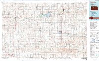
1985 Map of Plainville
USGS Topo · Published 1990About this map
Nicodemus, the historic African American settlement in the heart of the Kansas plains, stands as a focal point in this 1980s landscape. The map illustrates the region's complex water management and recreation systems, anchored by the Webster Reservoir and the adjacent Webster State Park. This mid-century infrastructure is balanced by the persistence of the South Fork Solomon River and Bow Creek as they weave through traditional agricultural townships.
Find a feature on this map
71 named features on this map. Tap any name to fly to it.
Don’t see what you’re looking for? This feature index may not catch every label — zoom into the map to look around manually.
Map Details
Editions of this 1985 Plainville Map
2 editions found
Other maps of this area

1893 · Ellis
USGS Topo · 1:125,000

1893 · Smith Center
USGS Topo · 1:125,000

1893 · Norton
USGS Topo · 1:125,000

1893 · Phillipsburg
USGS Topo · 1:125,000

1893 · Hill
USGS Topo · 1:125,000

1896 · Osborne
USGS Topo · 1:125,000

1896 · Russell
USGS Topo · 1:125,000

1896 · Hays
USGS Topo · 1:125,000

1896 · Plainville
USGS Topo · 1:125,000

1952 · Webster Dam
USGS Topo · 1:24,000