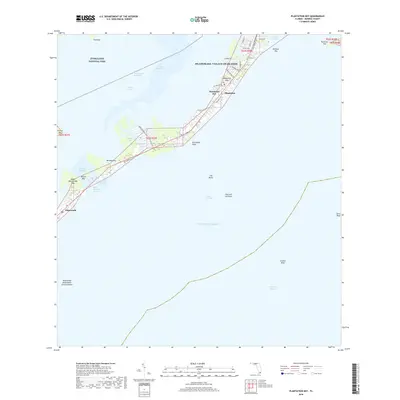
2018 Map of Plantation Key
USGS Topo · Published 2018About this map
Islamorada, Village of Islands serves as the central hub of this island chain, where development clusters along the historic Old Overseas Hwy. The landscape is a complex marine environment of keys and channels, including the protected waters of Everglades National Park to the northwest. This modern survey shows the significant residential footprint on Plantation Key and Windley Key, defined by intricate canal systems and local roads like Indian Mound Trl and Plantation Blvd. Between the settlements of Plantation and Islamorada, the map traces the critical transit corridors of the Intracoastal Waterway and Whale Harbor Channel. Beyond the shoreline, the survey documents the submerged hazards and landmarks of the Hawk Channel, including the Islamorada Underwater Coral Gardens and named reefs like Davis Reef and Crocker Reef.
Find a feature on this map
46 named features on this map. Tap any name to fly to it.
Don’t see what you’re looking for? This feature index may not catch every label — zoom into the map to look around manually.
Map Details
Editions of this 2018 Plantation Key Map
This is the sole edition of this map. No revisions or reprints were ever made.
Other maps of this area

1947 · Rock Harbor
USGS Topo · 1:24,000

1949 · Rock Harbor
USGS Topo · 1:24,000

1956 · Miami
USGS Topo · 1:250,000

1958 · Miami
USGS Topo · 1:250,000

1971 · Upper Matecumbe Key
USGS Topo · 1:24,000

1971 · Tavernier
USGS Topo · 1:24,000

1971 · Plantation Key
USGS Topo · 1:24,000
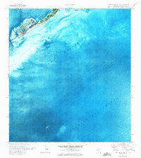
1971 · Lower Matecumbe Key
USGS Topo · 1:24,000

1972 · Calusa Keys
USGS Topo · 1:24,000
1982 · Homestead
USGS Topo · 1:100,000
Featured Places
- Islamorada, FL
- Plantation Key Colony, Islamorada
- Plantation Key, FL
- Plantation, Islamorada
- Monroe County, FL